About Us
With a global vision, the industry is deeply engaged and committed to becoming a leader in high-precision 3D laser real scene technology
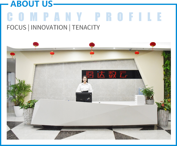
Wuhan Hi-Cloud Technology Co.,Ltd. founded in 2012, and is a holding company of Guangzhou Hi-Target Satellite Navigation Technology Co.,Ltd (stock code: 300177) with more than 200 team members and a product service network covering the whole country.
Hi-Cloud has been committed to the development, application service and industrialization of high-precision 3D laser series products for long term. It has taken the lead in overcoming the key core technology of full waveform LiDAR, breaking the long-term monopoly of foreign technology. It has formed a full series of product line layout of 3D laser "sea, land and air", and is far ahead in the application field of high-precision of domestic equipment. It is one of the few 3D laser solution providers in China that fully master the core technology of LiDAR and realize industrialization. Products and technologies are widely used in geographic informationsurveying and mapping , digital city, industrial digitization and other fields to provide technical support for the construction and application of digital 3D world.
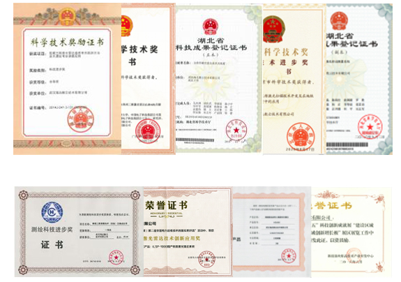
Hi-Cloud has applied for and owned 105 patents, 48 software copyrights, won a number of provincial and ministerial scientific and technological progress awards, won the title of "Gazelle Enterprise" in Wuhan East Lake Hi-TechDistrict for six consecutive years, and has been successively rated as a “High-Tech Enterprise”, Hubei enterprise technology center, an "Invisible Champion" in market segments, and"Little Giant" enterprise in Hubei Province.
In the future, Hi-Cloud will always adhere to the localization of high-end equipment as its own responsibility, and continue to promote the industrialization of domestic high-precision LiDAR, committed to become a global leader in 3Dlaser real scene technology.
Hi-Cloud -- the leader of 3D laser real scene technology
360m² 100-thousand-grade dust-free workshop, indoor long distance dust-free optical axis debugging field. The cleaning, optical axis debugging and system assembly of the LiDAR products are conducted here.
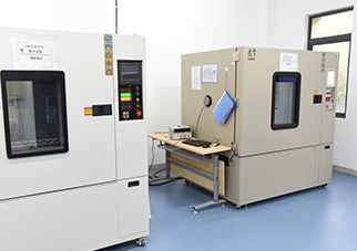
Used for high and low temperature screening of parts of LiDAR products, high and low temperature test of key components, high and low temperature test of whole system, to continuously improve product quality and reliability.
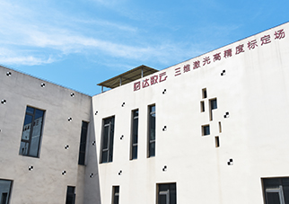
The position accuracy reaches the mm level in order to ensure the delivery accuracy of the scanners. It is used for the whole machine verification test, process detection and final system application effect detection of the LiDAR products.
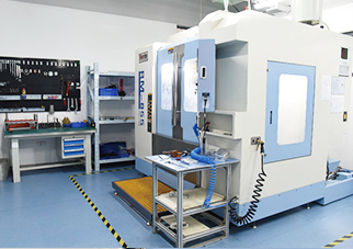
It is used for rapid verification, feasibility demonstration and process optimization of LiDAR product structure development, shorten product development cycle and improve the comprehensive strength of product research and development.
Software strength
>First prize of China Geographic Information Technology Progress: precision 3D Measurement Technology (equipment) and integrated application
>China's innovative geographic information product: high precision full waveform 3D laser scanner
>Second prize of geographic information technology progress: research and application of key technologies of urban housing safety intelligent management
>National major special project: development of high sensitivity and high resolution lidar device
>Excellent enterprise award of China Innovation and entrepreneurship competition and the second prize of Hubei Province
>Third prize of scientific and technological progress of Hubei Province: Airborne 3D lidar remote sensing archaeological survey method and application of archaeological survey of large sites
>Second prize of national scientific and technological progress in surveying and mapping: Airborne 3D laser scanning remote sensing archaeological investigation and monitoring method of Jingzhou great site
>Registration certificate of scientific and technological achievements in Hubei Province: full waveform lidar technology and device / airborne laser mobile measurement system
>Second prize of China Geographic Information Science and Technology Progress Award: key technology and application of air ground integrated 3D laser scanning digital highway life-cycle service
>First prize of Guangxi technological invention: key technologies and equipment of configurable adaptive nxm array 3D lidar
>Second prize of Beijing Science and Technology Progress Award: development of mobile 3D laser scanning technology and its application in subway safety measurement
>National power inspection technology innovation and Application Award: ilsp-1000 domestic airborne lidar system and zhibeak pm-1500 airborne lidar system


 Top
Top