Top
TopProducts
Fully master the core technology of 3D laser, and have formed the layout of a full series of 3D laser "sea, land and air" product lines.

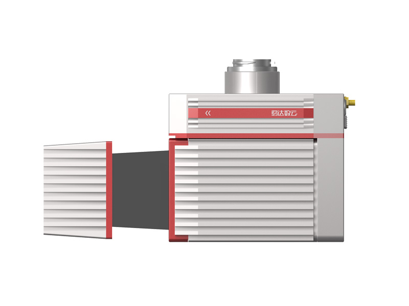
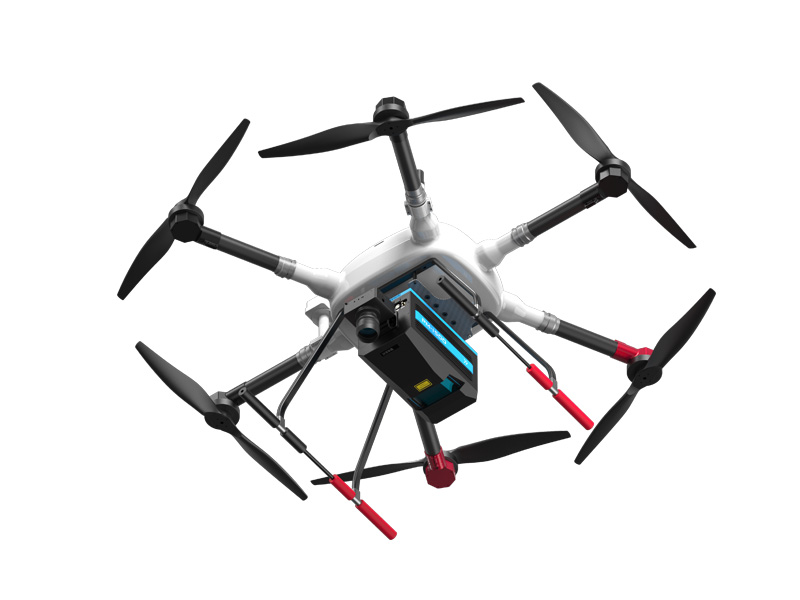
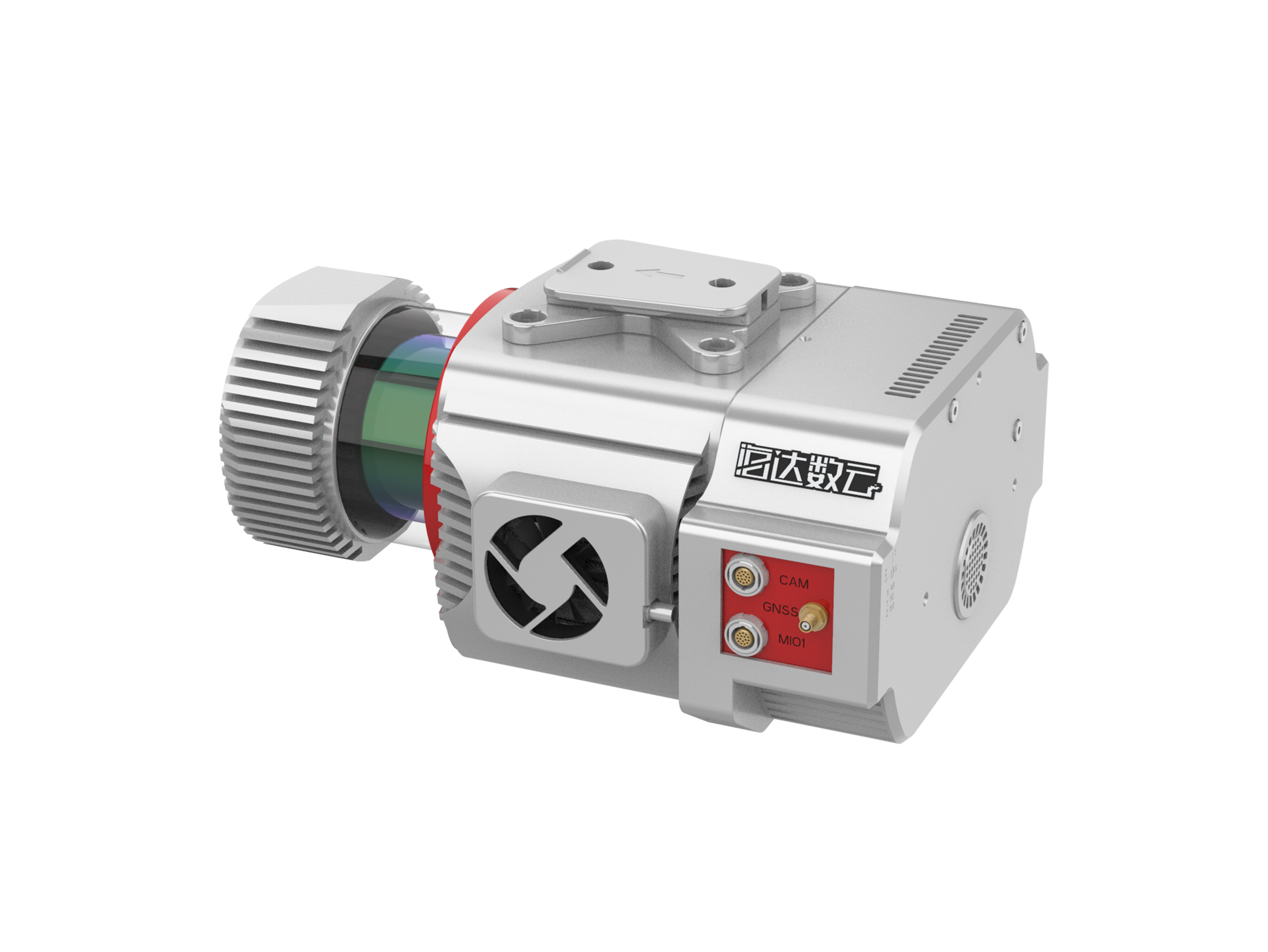
HiScan-Z High-Precision Laser Mobile Measurement System
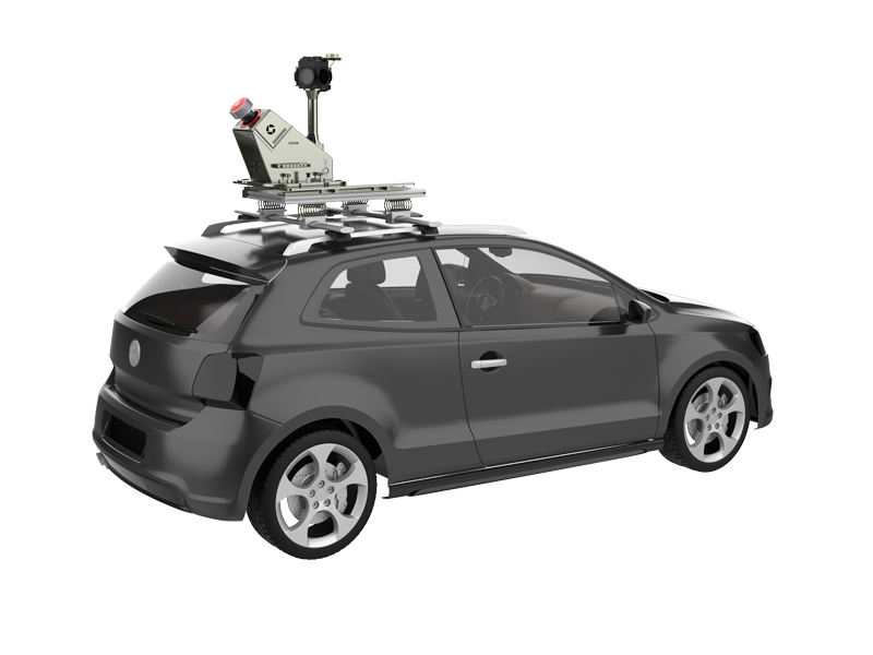
HiScan-Z high-precision laser mobile measurement system is a Z+F LiDAR based surveying and mapping equipment which developed by Wuhan Hi-Cloud Technology Co., Ltd.. The system highly integrates sensors such as 2D laser scanning equipment, satellite positioning module, inertial navigation unit, odometer, 360° panoramic camera, assembly control module and high-performance computers. It is encapsulated in a rigid platform, can be easily installed on cars, ships or other mobile carriers. During the high-speed movement of the carrier, it can quickly obtain high-precision positioning and orientation data, high-density point clouds and high-definition continuous panoramic image data.
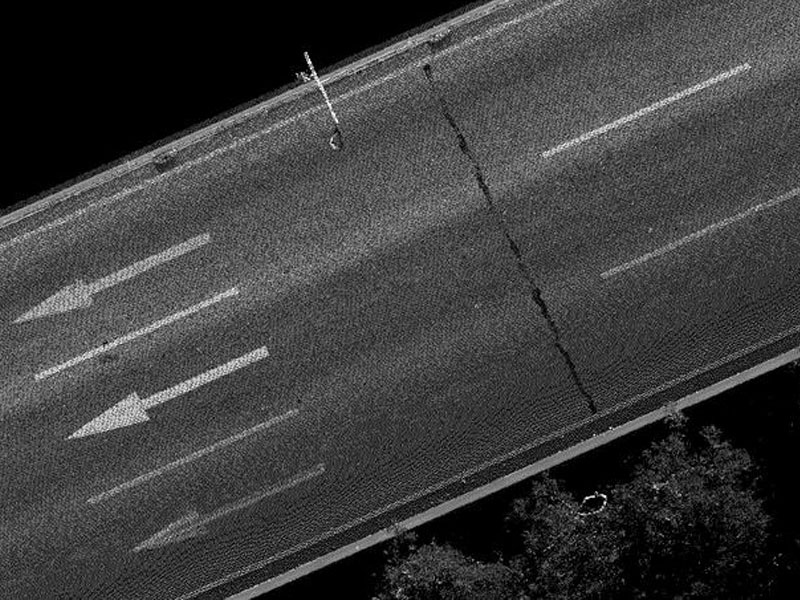
The system can easily complete the production and processing of vector map data, street view data and geographic data, and is widely used in basic topographic surveying and mapping, urban municipal components/garden census, traffic survey and design, traffic information census, street view map service, digital city and other fields.
Characteristic

Easy to store
pluggable data storage design.

Easy installation
easy installation, no need to modify the carrier.

High precision
high point cloud density, high point recognition rate, high measurement accuracy.

High reliability
high degree of productization, stable and reliable system.

High intelligence
seamless integration of point cloud and panorama.

Integration
highly integrated, integrated solution.
Parameter
|
Items |
HiScan-Z |
|
Number of Scanners |
1 |
|
Range Measurement |
119 m |
|
Laser Frequency |
1,010,000 points/ s |
|
Range Accuracy |
0.9mm@50m |
|
Angle Measurement Resolution |
0.0088 ° |
|
Scan FoV |
360 ° |
|
Panoramic Camera |
Ladybug/HD Camera (optional ) |
|
Panoramic Camera Resolution |
30M / 75M pixels |
|
Accuracy |
5cm@100m |
|
Scan Speed |
Max.200 scans/s |
Application
Related product recommendation
iAqua
Shipborne 3D Laser Scanner